South Yorkshire > Rotherham
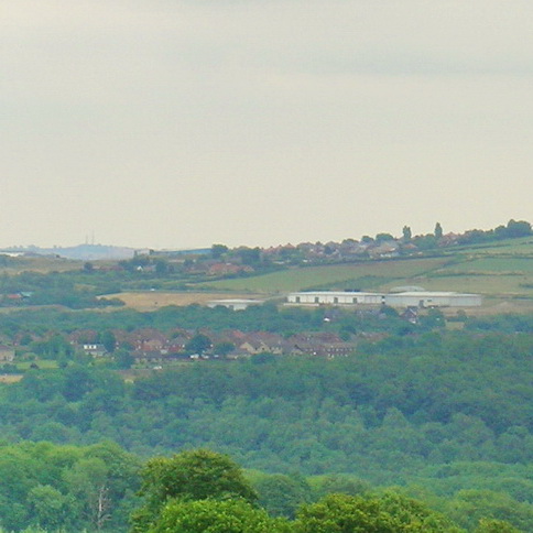
Rotherham is one of four Metropolitan Borough Councils in South Yorkshire and one of eight which make up the Sheffield City Region. The borough is 28,653 hectares in area, over half of which is rural. Rural areas are characterised by attractive villages and rolling countryside.
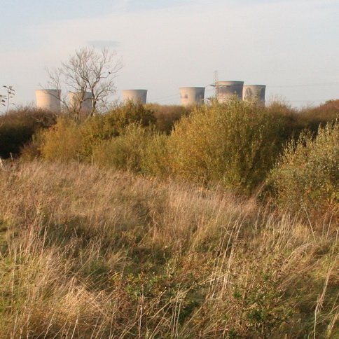
The landscape of Rotherham is formed from Magnesium Limestone in the east with its areas of large arable fields, limestone ecological character and associated geological features. The west of the borough comprises coalfield landscapes, which has a mix of built-up settlements, industrial areas and farmed countryside, with pockets of woodland and reclaimed landscapes.
Rotherham MBC has a small Landscape Design Team of 4 Landscape Architects who provide advice on Landscape and Green infrastructure matters in relation to both the local plan and Development control. We also provide a Landscape Consultancy Design Service in support of the Council’s capital investment programme.
Documents
Rotherham Landscape Character Assessment identifies broad landscape character types for rural parts of the borough. http://www.rotherham.gov.uk/downloads/file/1054/landscape_character_assessment_2010
Link to Rotherham MBC’s Adopted Local Plan - Core Strategy Document. http://www.rotherham.gov.uk/downloads/file/1571/adopted_rotherham_core_strategy
LCA & any other GIS boundaries are available on request. There are plans in progress to have a community map system to show all of these layers via the council website also but this won’t be completed until the local plan is adopted.
Landscape / Planning Contact
Stefanie Harrison